views
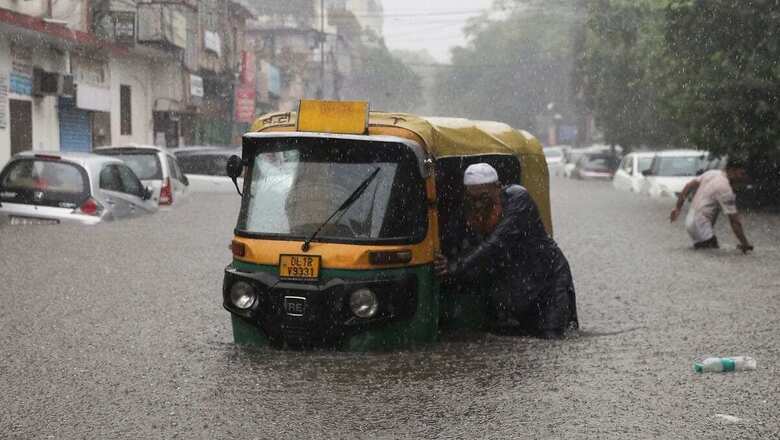
Torrential rains exceeding 200 mm have pounded North India in the last 24 hours, putting several states from Jammu and Kashmir to Haryana on red alert for the second consecutive day. The Safdarjung observatory in Delhi recorded 153 mm rainfall on Saturday – its highest-ever in July in 41 years.
LIVE | Rain News: 10 Killed as Monsoon Wreaks Havoc Across North India; Shah Speaks to Delhi, J&K LGs
Widespread rains, which initially brought a welcome relief from the heat and humidity, have now turned disastrous in hill states with overflowing rivers causing flash floods and landslides. Localised flooding has led to certain route closures with advisories issued for tourists, while cities in the plains are battling traffic woes.
“There has been a strong interplay between an active western disturbance over the Himalayas and a vigorous monsoon leading to extremely heavy rains over major parts of the region,” said the India Meteorological Department (IMD).
While it is usual for the southwest monsoon to bring heavy rain over the country in July, it is the intense western disturbance that has further strengthened the rainfall activity. These are rainy systems originating in the Mediterranean region, which impact the western Himalayas and bring rain.
According to meteorologists, the monsoon trough – a characteristic feature of this season – is also active and its western end is south of its normal position and eastern end to the north. There is also a cyclonic circulation over central Rajasthan, all of which together have contributed to heavy rains.
Rainfall activity now moves east
Jammu and Kashmir, Uttarakhand, Himachal Pradesh as well as parts of Punjab, Haryana and Delhi remained on red alert for Sunday as heavy rains continued. Chandigarh received 302 mm of rainfall on Saturday, while it crossed 220 mm in Ambala (Haryana), 160 mm in Una (Himachal Pradesh) and above 120 mm in Dharamshala, Manali (HP) and Bhaderwah (J&K).
Delhi’s Safdarjung observatory recorded 153 mm rainfall – its third-highest since 1958, when the station recorded 266 mm in a single day on July 20 and 169.9 mm rainfall in just 24 hours on July 25, 1982.
While the rainfall intensity will decrease over North India after July 11, it will increase over the eastern states as the rainy system moves eastwards. The movement of the system has been slow, as it continues its interaction with monsoonal winds.
Uttar Pradesh, Bihar, Madhya Pradesh and parts of Jharkhand are likely to witness heavy rains over the next five days at least till July 13. However, the rainfall intensity will be particularly high over Sikkim, Assam and Meghalaya, Arunachal Pradesh, Nagaland, Manipur during the next five days. The IMD has already sounded an orange alert for these states.
Monsoon deficit down to -1%
The four-month monsoon began this June and the seasonal rains covered the entire country on July 2, six days ahead of its normal date. While the June rainfall ended with a deficit of 10 percent across the country, the conditions changed over the last week with rainfall activity increasing over several parts of India.
The monsoon rainfall deficit has now come down to just -1 percent, with rains over northwest India now in excess, +45 percent above the long-period average (LPA). Despite the impact of evolving El Nino conditions, the weather department had predicted a normal monsoon and rains for July – critical for sowing rain-fed kharif crops.
According to IMD chief Dr M Mohapatra, there is a good probability that the overall rainfall for July will end on the positive side.


Comments
0 comment