views
The Nepal cabinet on Monday approved a fresh political map which included Limpiyadhura, Lipulekh and Kalapani as part of its territory.
Nepal Foreign Minister Pradeep Gyawali wrote on Twitter, “The official map is being made public by the Ministry of Land Management soon.”
The decision was hailed by the country’s Tourism Minister Yogesh Bhattarai who said in a tweet, “Today, the decision by the Council of Ministers of the Government of Nepal will be written in golden letters in the pages of history.”
This is perhaps for the first time in several years that India's historically connected neighbour and friend has taken such a severe confrontational stand even as the issue has remained simmering for a while.
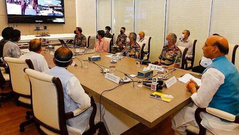
The move comes 10 days after Defence Minister Rajnath Singh inaugurated a link road on the Kailash Mansarovar route in Pithoragarh in Uttarakhand, leading to Lipulekh.
Nepal’s foreign ministry had issued a press release objecting to the link road, claiming it passes through Nepali territory. India had rejected the claim, saying it “lies completely within the territory of India”.
India has said the road follows the pre-existing route used by pilgrims of the Kailash Mansarovar Yatra. “Under the present project, the same road has been made pliable for the ease and convenience of pilgrims, locals and traders,” an official said.
But in a rare move a day later, Nepal’s foreign minister summoned Indian ambassador Vinay Kwatra and issued a diplomatic note on the road inaugurated.
Kwatra reiterated what the Ministry of External Affairs spokesperson had said in a statement issued on May 9. He said, “India is committed to resolving outstanding boundary issues through diplomatic dialogue and in the spirit of our close and friendly bilateral relations with Nepal.”
Singh had inaugurated the 80km link road between Dharchula in Uttarakhand to Lipulekh pass along the border with China, the gateway to Kailash Mansarovar. At the time, he had said that with the completion of the link road the arduous Kailash Mansarovar Yatra could be undertaken in a week’s time as compared to two-three weeks earlier.
The road also means that 84% of the pilgrimage journey on land will now be undertaken in Indian territory and 16% in China, as opposed to 80% of the journey being undertaken in foreign land earlier.
Nepal’s foreign ministry in a statement called the move a “unilateral act” and said it “runs against the understanding reached between the two countries including at the level of the prime ministers that a solution to the boundary issues would be sought through negotiation”.
MEA Spokesperson Anurag Srivastava said, “India and Nepal have established a mechanism to deal with all boundary matters. The boundary delineation exercise with Nepal is ongoing.”
Meanwhile, Army Chief General Naravane also indicated that Nepal was acting at the behest of China in its protest against the road.
Speaking at a webinar organised by the Manohar Parrikar Institute of Defence Studies and Analysis, he said, “There is reason to believe that they (Nepal) might have raised this issue at the behest of someone else and that is very much a possibility.”
Last year, following the carving of the Union Territory of Ladakh from Jammu and Kashmir, the new map issued by India showed Kalapani as part of Pithoragarh.
Nepal had raised objections even at that time. The then MEA Spokesperson Raveesh Kumar, in his press briefing on November 7 last year, had said, “Our map accurately depicts the sovereign territory of India. The new map has in no way revised our boundary with Nepal.”





Comments
0 comment