views
Torrential rains have receded across northwest India, but Uttarakhand will remain on alert during the next five days. The India Meteorological Department has issued an orange alert for the vulnerable hill state till July 17.
With monsoon conditions active, the weather department has warned of ‘very heavy’ to ‘extremely heavy’ rains over Uttarakhand in the next five days. “Some districts like Haridwar, Pauri Garhwal are likely to get more impacted. The intensity of rain could again increase around July 16, so people should remain alert,” said Bikram Singh, head of the regional meteorological centre in Dehradun.
Over the past 24 hours, Roorkee has recorded about 300 mm rainfall, followed by Laksar near Haridwar at 220 mm and 212 mm at Sambhal in West Uttar Pradesh. Rudraprayag, too, recorded about 100 mm rain on Wednesday.
LIVE | Delhi Flood: Rainfall, Gusty Winds Likely in Delhi Today; Yamuna Water Level May Recede Soon
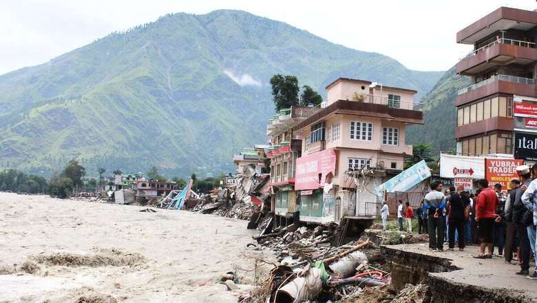
Ravaged by one of the worst floods in decades, northwest India is yet to recover from the widespread damage caused by a record downpour that began on July 8. While the rainfall has now begun to recede across Punjab, Haryana and Himachal Pradesh, the latest forecast issued on Thursday indicates some isolated rainfall activity can be expected in north Haryana and Himachal over the next few days.
“Though the intensity of rainfall may not be as high as in the previous spell, it will continue. However, the concerning factor is that the soil is saturated with water, so its capacity to absorb more will be less. This increases the surface runoff and chances of flooding, especially in hilly regions,” said senior IMD scientist Surender Paul.
This could also exacerbate the risk of landslides across vulnerable routes leading to the hill states, with officials urging people to exercise caution and avoid travel to these states. The weather department has also urged farmers to postpone sowing of crops until the current rainfall activity fully subsides and optimum moisture conditions are maintained.
Monsoon conditions are likely to become active again around July 17 with Madhya Pradesh likely to witness an increase in rainfall. With the weather conditions continuously evolving, the IMD will be updating its forecast since its five-day prediction carries higher accuracy.
The latest forecast indicates that a cyclonic circulation is likely to form over northwest Bay of Bengal around July 16, and a fresh western disturbance is also likely to impact the Himalayan region over the coming days.
The overall monsoon rains are now 1 per cent above the long-period average (LPA) across the country, with northwest India highest at 56 percent above the LPA.


Comments
0 comment