views
The Indian Space Research Organisation (ISRO) has released first images of the glacier burst in Uttarakhand’s Chamoli district in which 32 people have so far been confirmed dead and over 170 remain missing.
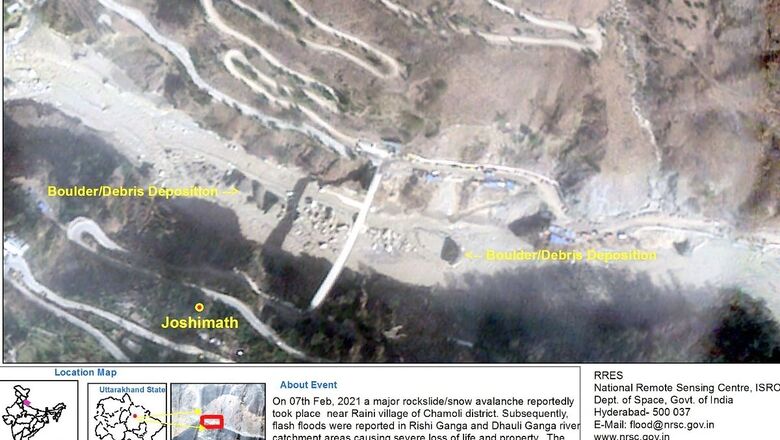
The satellite images, released by the ISRO’s National Remote Sensing Centre (NRSC), shed light on the damage to infrastructure at the Tapovan hydroelectric plant. The image shows at least two bridges that were washed away in the flood. Two other structures are seen damaged, while the image also shows deposition of debris in one spot. Sluice walls of the structure were also submerged in the deluge.

(Image: ISRO/NRSC)
ALSO READ: Tonnes of Rocks, Sludge, Hypothermia Scare: Time Running Out for Those Trapped Since U’khand Glacier Burst
Another photo shows damage to infrastructure at Raini village, where a bridge and a road were washed away by the Rishiganga river. Another power plant, located in the village, also suffered severe damage.
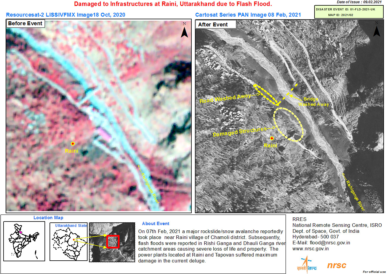
(Image: ISRO/NRSC)
A view of the Dhauliganga river shows the deposition of boulders and debris. Flash floods in the catchment areas of Rishiganga and Dhauliganga rivers were responsible for significant loss of life and property.
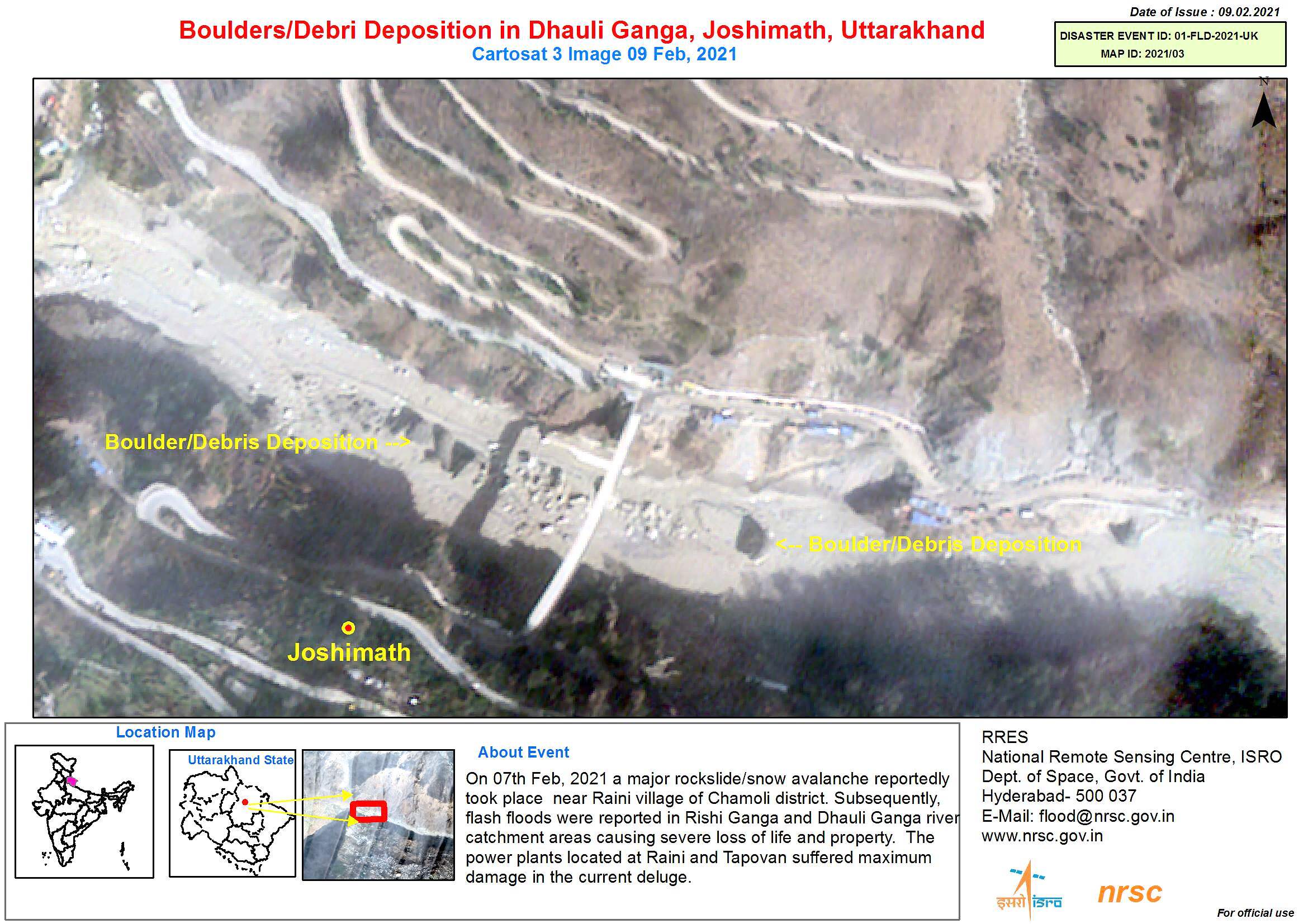
(Image: ISRO/NRSC)
The images were captured using CARTOSAT-3, an advanced earth observation satellite that has been developed by ISRO.
An Indo-Tibetan Border Police (ITBP) reconnaissance team visited the glacier-break site on Wednesday that is suspected to have triggered the massive flash flood in Uttarakhand even as its chief SS Deswal said the rescue operation to locate the 30-35 workers trapped in Tapovan tunnel will continue till it reaches a “logical conclusion.”
Read all the Latest News, Breaking News and Coronavirus News here




Comments
0 comment